 Farewell Sunny & Humid
Just a couple of metres from where we were camped, a couple of bower birds had build their nest. This nest had an entry and exit and they had lined the walkways with white stones. They had layered the nest with these white stones. There were a collection of all different items they had collected over time, from beer can tops to silver objects. It was fascinating to see them at work during the day. Apparently they do not lay eggs in this nest, it is more for show.
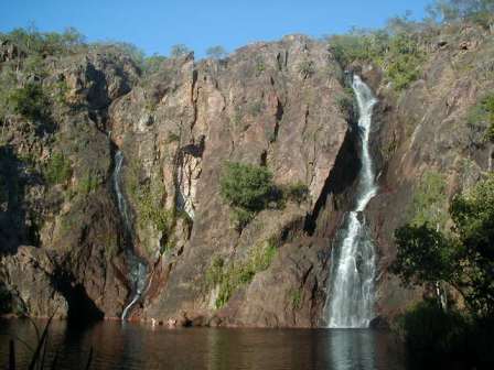
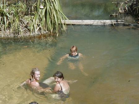
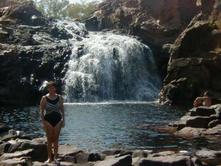
Buley Rock Hole was another favourite spot. This spot is a series of
cascading waterfalls interrupted by magnificent rock holes, some up to 7 metres
deep. The water coming from underground springs is crystal clear, mild in
temperature and it is a great way to spend hours relaxing in this natural cool
swimming hole. Quite close was the
 We
visited a couple of attractions which could only be reach by 4 WD. The
first was the Blythe Homestead and then we took a shortcut to the
 road, track, rough path, almost non existent track was
unbelievable, and at one stage there was just a huge amount of boulders and
rocks ahead of us. As we were working out how to tackle what lay ahead,
the army turned up behind us. They had arrived at a most appropriate time
and were able to give us directions as to which way to go. The army
drivers "under instruction" were being put through some training and
use this track . We were able to watch them go through this section
first before attempting it ourselves. From then on we were on our
own but finally reached the
Another trip by 4 WD was to
It is such a small world. In two days we had bumped into Julian and
Barb Arnold from
Charlie
Who???????????....... We had four beautiful days at
Litchfield and could have stayed longer. Two hours drive and we arrived
at
 Butterfly
Gorge was an attraction' that we had read about. Six people had attempted
to reach this gorge the day before and only one had actually made it. Not
to be outdone, we made the 4 WD trip of 17 kms. into this remote park. It
is surrounded by towering sheer rock faces, edged by dense riverine
vegetation. You follow the river along until you reach two very steep
rocky outcrops. We managed the first easily enough. Another
short walk to the next very steep rock outcrop again a tricky climb up and down
and we came to the sandy beach with a large swimming hole. To reach the
actual gorge, you had to swim about 300 metres across the pool and through the
narrow opening to the gorge. We decided that what we saw was peaceful and
beautiful enough, so after a rest and photo session we made our way back.
Not many people would actually make it to this part of the gorge.
On the same road as Butterfly Gorge but easily accessible are the Douglas
Hot Springs(photo). These springs which come out of the ground at a
temperature of over 60 degrees flow down into an oasis where the hot water
meets the
 We
enjoyed the Douglas/Daly River Park so much that we ended up staying three
nights. We met a couple from Greensborough and enjoyed a couple of nights
playing cards and enjoying a few drinks with them. From there we headed
to Umbrawarra Gorge just out of Pine Creek, a 5 km long gorge surrounded by
granite boulders and steep red cliffs. We walked right into the
gorge over rocks and rockpools. This gorge is not as popular as it is off
the beaten track for most people.
The next day we headed down to Katherine where we stocked up on supplies, caught up on housekeeping, and answered our emails. Katherine was warmer than on our northbound trip, so time was spent in the pool and trying to keep cool.
You'll Never, Never Know
........ Our next stop was Mataranka just down the
road. The home of "We of the Never Never" written by Jeannie
Gunn. This township has a museum which includes the history of the area
including the events in the area during World War II. We visited the
cemetery and the relics of the old Elsey homestead and also visited the replica
built for the making of the movie which is situated at
After Nearly 4 Months We Feel Like We're Heading Towards Home ...... It was all downhill from here and there is a definite feeling of being on our way home. We had a quick stop off again at the Daly Waters Pub before heading further south. Our next night was an off road camp spot about 89 km south of Renner Springs. It was then onto Tennant Creek, with a visit to the Tennant Creek Telegraph Station, 10 km north of the town. The original stone buildings are being restored. The Desert Harmony Festival was in full swing when we arrived in Tennant Creek. We checked in at the caravan park, checked out the town and tourist information centre, went to an aboriginal art exhibition and a Cathy Freeman Exhibition of photography then ended up at the Memorial Club to sit and watch the Carlton versus Eagles final in air conditioning comfort drinking a couple of 'barbed wires' for good measure. We thought the weather was to be cooler but Tennant Creek greeted us with 35 degrees. A quick dip in the park pool later in the day cooled us down. We would rate Tennant Creek about the same as Cloncurry.
 Who Say's The Devil's Lost His Marbles
........The Devils Marbles Conservation Reserve was our next
stop. Thousands of enormous precariously balanced boulders make this
reserve a spectacular landmark. Many of these boulders are the size of
low-rise buildings just sitting on top of each other. Some of these
marbles are over 6 metres in diameter and the aborigines believe that the rocks
are the eggs of the Rainbow Serpent, the creator of their dreamtime.
Next day saw us drive and drive through the small towns of Wauchope with a population of seven, Wycliffe Well well known for its UFO's. Its amazing what these small towns grab onto in the way of sightseeing to promote themselves. Then it was Barrow Creek, well known for its pub. We stopped here to sample the beer and mix with some of the locals as well. It was Sunday and many of the aborigines had come to town from outlying villages for a Sunday picnic gathering. Very interesting.
 Native Gap, An Aboriginal Sacred
Site, Read On!....... That
night we decided to stay at Native Gap a conservation area just off the road
about 114 km north of
No further
updates to this page.