Southward
Bound, Heading For Home, But Still A
In Alice Springs we booked into the
Gaps, Chasms, Gorges,
Holes, Valleys and More ....... We packed up our camping gear
and set out to travel into the
The Ochre Pits were next on our sightseeing list. For generations, the local aborigines used this quarry for natural ochre which was used for traditional ceremonial body decoration and other paintings. The colourings in the quarry range from cream through the browns, reds to deep maroon, like a rainbow.
It was then onto Ormiston Gorge where we were to camp for the next two
nights. The camp ground was very popular and it was lucky that we arrived
not long after lunch and secured a spot. We set up camp and then walked
down to the deep waterhole. There were a group of school children who
were brave enough to swim. Ormiston Gorge and Pound is one of the most
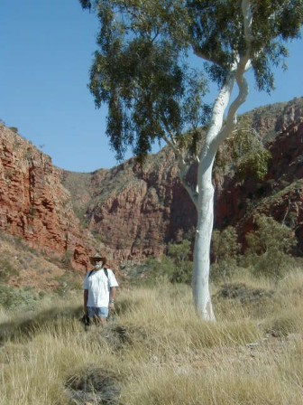
spectacular features of the  There are a range of short, longer and overnight walks that visitors can
take. That night was the coolest night that we have experienced since
leaving home. A cool change had arrived and we had left
The next day was perfect temperature wise (24 degrees). So we were up
early to do the Pound Walk which took three and a half hours to
complete. It was a fantastic walk up rugged ridges, down into valleys,
across spinifex grasslands, and through the
We reached our camp site for a short rest and lunch and then took to the road to see Glen Helen Gorge. Again there is a swimming hole surrounded by sandstone walls. Because of the amount of water in the hole, it was impossible to walk into the gorge. Redbank Gorge was our last visit for the day. This place can only be reached by 4 WD and a 30 minute one way walk to the gorge. By this time the legs were feeling a bit weary, but it was well worth the walk in to this narrow cathedral-like Gorge were again icy waters permanently block the deep narrow entrance into the range.
We enjoyed another cool night and then moved onto Gosse Bluff which is a meteorite crater formed over 140 million years ago. From a distance you can recognise the circular shape of the crater but from within the crater it looks like a mountain range. You need to apply for a $2 aboriginal permit to visit this sacred site which is off the main gravel road and is for 4 WD only. The aborigines tell another story which is part of their Dreamtime. It was then onto Hermannsburg. Well, what can we say about Hermannsburg, except that it needs a bloody good cleanup of litter which is everywhere. There was the historic Hermannsburg Precinct which you could visit by paying $4.00 to enter plus $3.00 to view the collection of Hermannsburg school of painters, descendants of Albert Namatjira. We decided to visit the supermarket instead and then made our way to beautiful Palm Valley, 21 kilometres in on a 4 WD gravel track to the camp ground.
 After
setting up camp we drove the last 4 km into the valley over a fairly bumpy,
sandy, rocky 4 WD track. It was late in the afternoon by this time so we
decided to do the short walk along the valley floor and back along the edge of
the escarpment. Our bigger trek was done the next morning. This
took 2 hours before breakfast and went right through
It was then back to
We set out for Ross River Homestead where we spent two nights camping in a
grassed camping ground. The place was very quiet which we thoroughly
enjoyed, and then the second night our peace was interrupted by a school group
from Echuca. We visited Trephina Gorge and N'Dhala Gorge before
attempting the 4WD track into Ruby Gap. These places were OK but the best
is in the
 The
campground was well laid out with plenty of green grass and good facilities but
overpriced at $22 for an unpowered camp sight. It was chock a block with
every man and his dog and every nationality. There were school groups,
families on school holidays, Japanese, backpackers but a noticeable lack of
"grey nomads". Interesting! We walked the Kings
Canyon Creek which is a short 1 hour return walk into the base of the Canyon
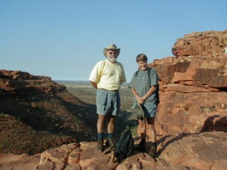
and unimpressive. The next day we walked the 5.5 km Kings Canyon Rim
which took 31/2 hrs to complete. It was extremely steep in parts, with
rocky terrain, sandstone terraces formed when the whole region was an inland sea
or lake. From the top of the canyon you looked down over 300 metres to
the valley below. It was best to do the walk early in the morning along
with everybody else, as it really warms up during the day. Unlike
the canyon creek walk the day before this walk was a highlight and certainly
shows off
Next day it was on to Uluru (Ayers Rock) 340 km down the road. The
camp ground here was again quite crowded but with nice green camping
areas. In both
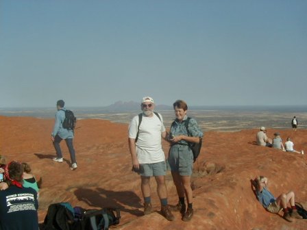
Ayers Rock is a massive monolith that has to be seen to be believed.
We decided to watch the sunset but for the first time in three and a half
months it was cloudy, so no sunset. The next morning along with everybody
else, it was out to see the sunrise at 6.30 am which for a short time showed some
different colourings on The Rock. At 7.15 am it was time for the big
climb to the top of the rock.
Rob's Description of the Climb.... Firstly the facts
and figures. The top of Ayers Rock is 862 metres above sea level and it is 9
kms around the base. The climb to the top is 1.6 kms. One third of
which is very steep. There is a chain to assist you with the climb.
The second third is moderately steep and the last third relatively flat.
However what is surprising is the wave like formations across the top of the
rock between 3 and 4 metres between the crests and valleys which you must cross
to reach top dead centre. At the top of the rock is an Australian
Geodectic Marker, pity the poor surveyor who had to carry his theodolite to the
top to undertake surveying operations.
The first part was very steep but slow as you could not overtake slower climbers. Then after the chain section the climb was relatively easy. The wind was extremely strong as you approach the top but the most amazing thing was that the mobile phone worked which gave us the opportunity to ring Scott and Liz's mum. The climb down was a lot easier and gave me the opportunity to do some videoing and take some photos. All in all not as strenuous as I expected but a real thrill when you have completed the round trip still in one piece.
Liz's Description of the Climb.... The climb was a strenuous slow climb with many stops along the first section due to the number of people climbing. These stops enabled you to have a rest and catch your breath. Thank goodness. Once you reached the top of the chain, it was just a white painted line showing you the way. There were some steep slopes, deep valleys and then a few ridges to walk along , not quite as steep as the beginning. You reached a certain point where the wind was blowing at 50 kph. I felt that I could be blown into one of the many craters or actually being blown off the rock. At this stage many people stopped and turned back, but being the determined intrepid traveller, I joined Rob on the top. The thought of descending was a bit daunting as it was quite steep. I decided to come down backwards which worked well as you didn't have to look down, and it was easier on the knees. I even managed to take a few photos. This was definitely "character building" for me. I was quite proud of my achievement.
The Olgas were 43 kms further on so we arrived there at lunchtime in the heat of the day. We decided to do two short walks one to 'The Valley of the Winds' Lookout and one into Olgas Gorge. The Olgas are larger and probably more impressive than the rock but do not have the same aura or attraction. It was then back to camp for a well earned beer and to watch the last quarter of the Grand Final at the hotel.
Our last night was clear blue skies and a perfect sunset so again we travelled out to the rock. It is a very festive occasion where people take their drinks and nibbles, chairs and cameras to take the perfect shot. By the time the sunset comes its a case of "who cares about the sunset".
Coober Pedy... Dust, Dust and More Dust..... On the approach to Coober Pedy all you see are mullock heaps and mine shafts with mining equipment scattered over the land. Signs everywhere warning you of the dangers of falling down mine shafts. Coober Pedy is a huge cultural shock. Not a blade of grass to be seen, very few trees and mullock heaps everywhere. It gave the feeling that you were visiting a different planet. The actual township is quite fascinating, after you get over the initial shock. Underneath the rough exterior there is a certain amount of sophistication, and this can be observed in the underground hotels, underground homes and some of the underground opal shops. Nearly half the population live in dugouts. Sounds a bit rough, no way. These are very interesting, appealing and comfortable homes and I think by far the best way to live in this harsh environment. Need another room, then just bring in a digger and a couple of mates and within a few hours a new room.
We visited the Coober Pedy Underground Pottery and went to see Crocodile Harry. He is an eccentric 73 year old man who lives underground just out of the town. He has lived there 26 years and charges $2.00 to enter his domain which is mind boggling. All his walls are covered with writings, paintings, photos, bras, underwear -- you name it, its on the wall. In his prime, he hunted crocodiles and lived with the aborigines and loved the young girls. He has lived a most colourful life and it is worth a visit. His home was also featured in the Mad Max III movie.
 We
were only staying one night but made the mistake of staying longer and found
ourselves right in the middle of a wind storm which blanketed the town in
dust. We went to see the Breakaways, which is 32 kms north.
It consists of colourful low hills which have broken away from the
The next morning the wind had settled a little and with the overnight rain
the dust had settled so we headed off early for Port Augusta. Just
a short hop of 540 km. After stocking up on supplies it was off to
the
No further
updates to this page.